The ground
is always
moving.
Continuous ground deformation measurements, anywhere on Earth, delivered to anyone who needs to know what the surface is doing.
Measurement, not interpretation.
Some ground movement is harmless — seasonal, structural, expected. Some is the first signal of something that matters.
We publish the measurements. You decide what they mean for your situation, your asset, your investigation.
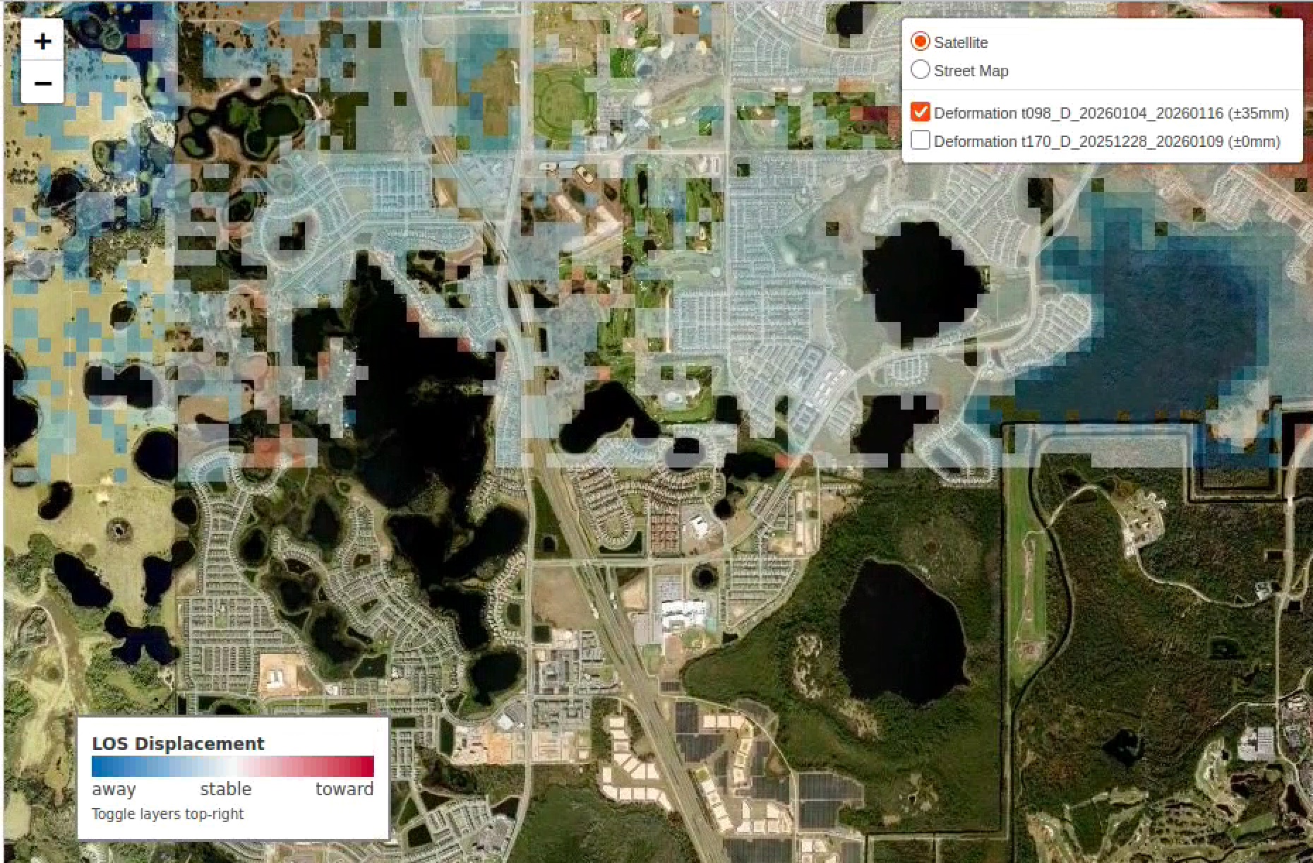
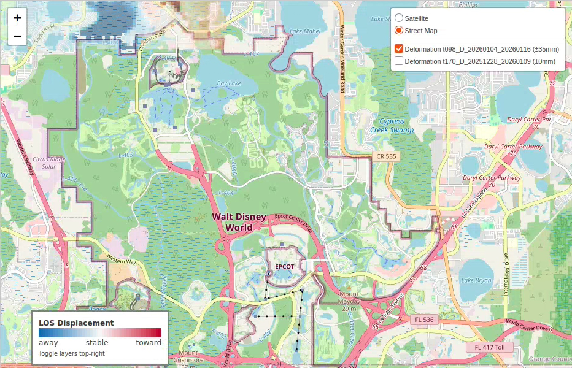
What the signal looks like.
The same data layer reveals different stories depending on where you look. Below: a residential corridor and a major commercial complex, twelve days apart.
What we deliver.
Ground deformation over your area of interest.
Millimeter-scale movement data, sampled across your defined polygon, with documented uncertainty.
Time series as far back as the data goes.
Every prior measurement we have for your AOI, exportable in standard geospatial formats. Yours to analyze, archive, share.
New data as it becomes available.
Updates flow into your dashboard or API endpoint as new measurements arrive. No setup. No site visits. No equipment.
Used by people who need to know.
The ground is the same substrate for every question. The use case is yours to define.
The ground holds signal.
We deliver the signal.
What it means is yours.
Tell us what you're watching.
Define the area, the cadence, the format. We'll tell you what's possible and what it costs.
hello@sinkholes.ai →